Manukan And Sapi Island Tour
Location Guide

Where Is Manukan Island

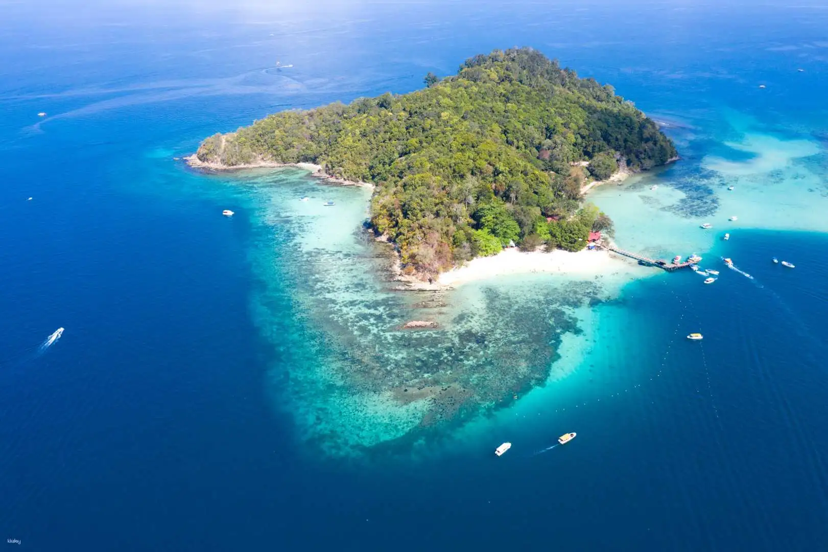
Manukan Island sits in the South China Sea as the second-largest island within Tunku Abdul Rahman Marine Park, approximately 8 kilometers off the northwest coast of Kota Kinabalu, Sabah. The island's position places it 20 minutes by speedboat from Jesselton Point Ferry Terminal, making it one of the most accessible coral-reef destinations in Malaysian Borneo. This guide provides the exact location, departure points, and navigation context for planning your visit.

8 min read Updated 2026-09-24 Fact-checked
Where Is Manukan Island

Quick answer

Manukan Island is located in Tunku Abdul Rahman Marine Park, 8 kilometers northwest of Kota Kinabalu city center in Sabah, Malaysia. The island sits at approximate coordinates 6.0078° N, 116.0028° E within a protected marine reserve established in 1974. Speedboats depart from Jesselton Point Ferry Terminal on the Kota Kinabalu waterfront, reaching the island in 15 to 20 minutes depending on sea conditions.

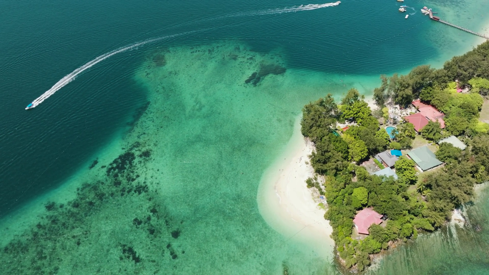
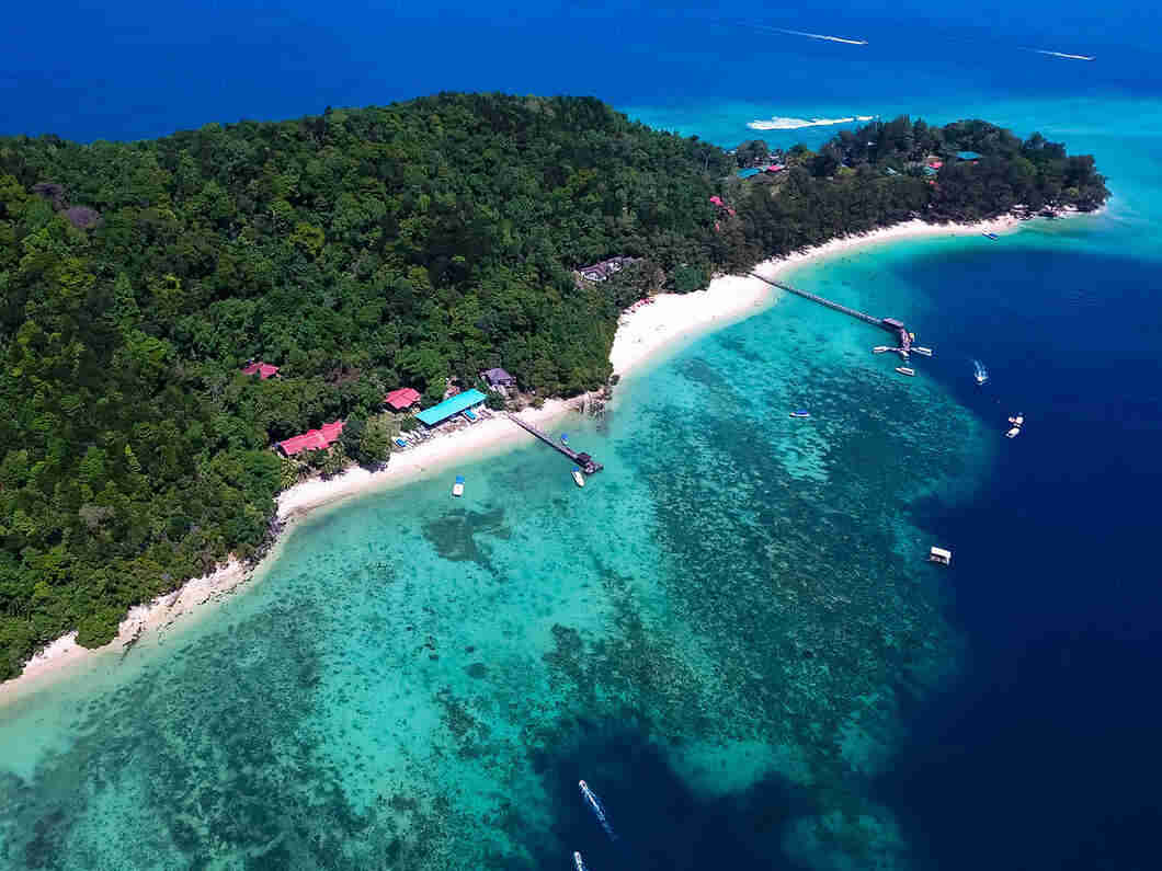
Manukan Island occupies 51 acres within a five-island cluster that forms Tunku Abdul Rahman Marine Park, Malaysia's first gazetted marine protected area. The island lies closer to the mainland than its northern neighbors Gaya and Sapi, positioned in a sheltered channel that provides calm waters year-round. The departure point for reaching Manukan Island sits at Jesselton Point Ferry Terminal, a dedicated boat facility at the western edge of Kota Kinabalu's central business district. The terminal coordinates all marine park traffic, with boat operators offering scheduled and charter services throughout the operating window from 08:00 to 17:00 daily. Visitors purchase marine park conservation fees at the terminal counter before boarding, with boats typically filling to 10 to 12 passengers per trip. The crossing follows a northwest bearing across Gaya Bay, passing close to Gaya Island's southern shoreline before turning west toward Manukan's main jetty. Geographically, where is Manukan Island within the broader Sabah coast context matters for understanding access logistics. The marine park boundary extends from the low-water mark of each island to approximately 2 nautical miles offshore, creating a protected zone that restricts fishing and anchoring. Manukan itself features a crescent-shaped eastern beach where the arrival jetty and main facilities concentrate, while the western and southern coasts remain undeveloped coral garden zones accessible only by kayak or guided snorkel tour. The island's central ridge rises to 100 meters elevation, covered in secondary dipterocarp forest that provides walking trails connecting beach zones. Navigation to the island requires no special permits beyond the standard 25 MYR conservation fee collected at Jesselton Point, valid for same-day visits to any island in the park. Boat operators maintain radio contact with park rangers stationed on Manukan, who monitor weather conditions and coordinate emergency response if needed. During northeast monsoon season from November through February, crossings may be suspended on days when wave heights exceed safe thresholds, though the sheltered position of Manukan typically allows operations when outer islands like Mamutik become inaccessible. The island's proximity to Kota Kinabalu International Airport creates a practical advantage for travelers with limited time—the airport sits 7 kilometers south of the city center, placing Manukan within 90 minutes of baggage claim when factoring in ground transport to Jesselton Point and boat transfer. This positioning has established Manukan as the default marine park destination for cruise ship passengers and business travelers seeking coral reef access without overnight commitment.

“The island lies closer to the mainland than its northern neighbors, positioned in a sheltered channel that provides calm waters year-round.”
Directions

Where Is Manukan Island and How to Reach It

Manukan Island is located within the Tunku Abdul Rahman Marine Park, approximately 3 kilometers off the coast of Kota Kinabalu, Sabah. The only way to access the island is by taking a scheduled boat service from the Jesselton Point Ferry Terminal.

Boat 15–20 min —

Jesselton Point Ferry Terminal to Manukan Island

Taxi 5–10 min —

City center to Jesselton Point Ferry Terminal

On foot 15–20 min —

From Kota Kinabalu city center to Jesselton Point

Proceed directly to the ticketing counters at Jesselton Point Ferry Terminal to register for your boat transfer. Ensure you have your identification documents ready for the terminal security check.

Opening hours

Where Is Manukan Island and What Are Its Opening Hours

Manukan Island operates daily, maintaining consistent access hours throughout the week for visitors exploring the Tunku Abdul Rahman Marine Park.

Monday
08:00–17:00
Tuesday
08:00–17:00
Wednesday
08:00–17:00
Thursday
08:00–17:00
Friday
08:00–17:00
Saturday
08:00–17:00
Sunday
08:00–17:00
Visitors should coordinate departure times with boat operators to ensure return transport before the island closes at 17:00.
Timing

The Best Time to Visit Manukan Island for Fewer Crowds

The best arrival window is 08:00–11:00 to avoid mid-day heat and large crowds. Planning your visit during this timeframe ensures quieter conditions for your arrival.

Weekday mornings

Low crowd density

—

Early arrivals experience the island before boat traffic peaks.

March to May

Moderate tourist volume

Warm, dry, 30°C to 32°C

These months offer consistent weather for island transit.

June to August

High visitor volume

Hot and humid, 32°C

Expect higher boat congestion during these peak summer months.

September to November

Lower visitor volume

Occasional rain, 28°C to 30°C

Intermittent showers help reduce total visitor numbers on the island.

Verdict: The optimal time to visit is Tuesday to Thursday between 08:00 and 11:00 during the months of April or October.

What to see

Key Features of Manukan Island at Tunku Abdul Rahman Marine Park

Manukan Island offers distinct zones ranging from active recreational hubs to quiet stretches of coastline. Orienting yourself around these primary areas helps in planning your movement across the island.

Main Jetty Area

Main Jetty Area

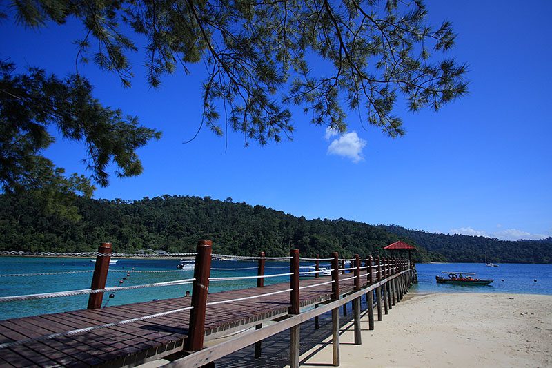
The primary arrival point features a wooden boardwalk that serves as the central hub for visitor activity. It provides immediate access to the island's facilities and basic amenities.

Walk to the end for clear views of the approaching boats.
West Beach

West Beach

This expansive stretch of sand is the island's primary swimming and water sports zone. It offers the longest shoreline for visitors to occupy during the day.

Stake out a shaded spot under the trees early.

Nature Trail

Nature Trail

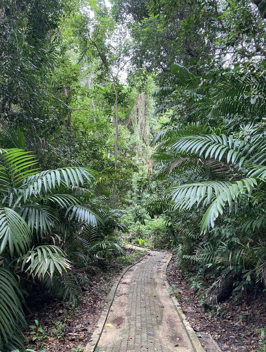
A network of jungle paths winds through the interior of the island, connecting the beach areas with the forested highlands. These trails allow for observation of local flora and monitor lizards.

Wear sturdy footwear and carry water for the jungle trek.

Eastern Coastline

Eastern Coastline

The eastern side of the island is generally quieter and less developed than the main beach zones. It provides a more secluded atmosphere for those walking away from the primary visitor facilities.

Visit during low tide to explore the exposed rocky coastline.

Checklist

Where Is Manukan Island and How to Prepare for Your Visit

Pack the right items and documents to make the most of your marine park visit.

Book

Check availability

Frequently asked

Frequently asked questions about where is manukan island

Everything you need to know about where is manukan island

Where is manukan island located?

Manukan Island is situated within the Tunku Abdul Rahman Marine Park, off the coast of Kota Kinabalu, Sabah, Malaysia. It serves as one of the primary gateways for exploring the biodiversity of this protected area.

How do I get to this Sabah marine attraction?

Travelers can reach where is manukan island by taking a boat from the Jesselton Point Ferry Terminal in Kota Kinabalu. Regular speedboats ferry passengers to the park throughout the morning, making it a accessible destination for day trips.

When is the best time to visit the island?

To avoid mid-day heat and large crowds, the best arrival window is 08:00–11:00. Arriving early ensures you have ample time to enjoy the water activities before the afternoon rush.

How much is the conservation fee?

The entrance fee is 25 MYR per foreign adult, which acts as a conservation fee. This payment is valid for all islands within the marine park for the duration of the day.

Is the island open to visitors every day?

The park remains open daily, including weekends and public holidays, from 08:00 to 17:00. This schedule applies consistently throughout the week to help you plan where is manukan island excursions.

What should I bring for a day trip to the park?

When planning your trip to this Kota Kinabalu landmark, bring sunscreen, snorkeling gear, and comfortable swimwear. Visitors should also carry their entrance fee receipt, as it is required to access other parts of the Tunku Abdul Rahman Marine Park.

Keep reading

More guides & pages